November 8th, 2023 at 8:14 PM ^
Are they next door to Fuckosu?
November 8th, 2023 at 8:32 PM ^
No, but the directions from Ann Arbor to Fuckosu haven't changed since the disco era printing of this Michigan map. South until you smell it. East until you step in it.
November 8th, 2023 at 8:15 PM ^
Love it. Thanks for the laugh!
November 8th, 2023 at 8:17 PM ^
Have a safe trip!
November 8th, 2023 at 8:22 PM ^
Have always liked this

November 8th, 2023 at 8:25 PM ^
Looks like a sweater with a tassel when the image is oriented like that.
November 8th, 2023 at 8:26 PM ^
Makes sense. Sweaters are soft.
November 8th, 2023 at 8:26 PM ^
I had no idea this was a thing. Thanks for the chuckle!
November 8th, 2023 at 8:32 PM ^
Yeah but how do you get there without looking at any signs????
November 8th, 2023 at 8:37 PM ^
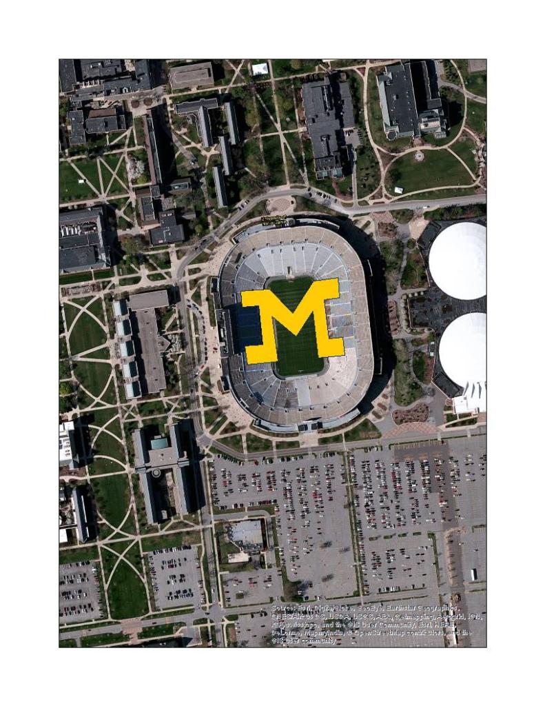
We had this map when I was a kid. It inspired me to slip a block M polygon on top of Notre Dame Stadium into a parks dataset I worked on for Ducks Unlimited. This polygon lived in the dataset as Wolverine Park for about 10 years until I tipped of my old manager to take it out. When you mapped the shapefile on top of imagery it looked like this:

November 8th, 2023 at 8:47 PM ^
Putting block M's on rivals stadiums and working for Ducks Unlimited? You sir, are doing the Lord's work
November 8th, 2023 at 9:16 PM ^
Ah, well I see someone finally rediscovered the town of beatosu.
...it had been uninhabited for several years.
November 8th, 2023 at 9:32 PM ^
This will be my third sojourn there in as many Novembers!
November 8th, 2023 at 11:29 PM ^
One thing for sure, you'll know when you get to the Michigan State Line when the road changes color & your vehicle's suspension starts shake and shudder violently.
November 9th, 2023 at 6:07 AM ^
And the proliferation of cannabis billboards, which ohio assuredly won’t allow because anywhere south of route 6 around bowling green is the cultural south
November 9th, 2023 at 8:32 AM ^
Oh my goodness, you can't be serious. lol
In the Toledo area, it's widely known that you can tell precisely when you've crossed the state line because the Michigan roads are crap. The Michigan counties are simply not able to compete with the city roads.
It's amazing what conclusions can be drawn from a position of bias.
November 9th, 2023 at 8:48 AM ^
The person you replied to is saying that the roads in Michigan are shit.
November 9th, 2023 at 12:28 PM ^
Oh good...then...well...
...nevermind.